|
usa | world | animals | vocabulary | health | science | math | history |
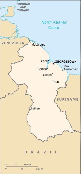
Map Courtesy CIA World Factbook
The Co-operative Republic of Guyana is a nation along the northern coastline of South America. It constitutes the western part of the wider region of Guiana (an Amerindian word meaning Land of Many Waters), and is bordered to the east by Suriname, to the south by Brazil, to the west by Venezuela and to the north by the Atlantic Ocean. The border with Venezuela is one that is disputed, as is the most southern part of the border with Suriname (upper Corentyne river).
At the time the first Europeans arrived in the area around 1500, Guyana was inhabited by Arawak and Carib tribes of Amerindians. European settlement began in the early 17th century with the Dutch, who established three separate colonies; Essequibo (1616), Berbice (1627), and Demerara (1752). The British assumed control in the late 18th century and were finally ceded the area in 1814. The three became a single British colony known as British Guiana in 1831.
The abolition of slavery in 1834 led to black settlement of urban areas and the importation of indentured labourers from India, China and Portugal to work the sugar plantations. This ethnocultural divide has persisted and has on occasion led to turbulent politics. Guyana achieved independence from the United Kingdom in 1966 and became a republic in 1970, remaining a member of the Commonwealth of Nations.
This article is licensed under the GNU Free Documentation License. It uses material from the Wikipedia article "Guyana".